
Clinton Gulch Dam Trail - A Relaxing Picturesque Walk
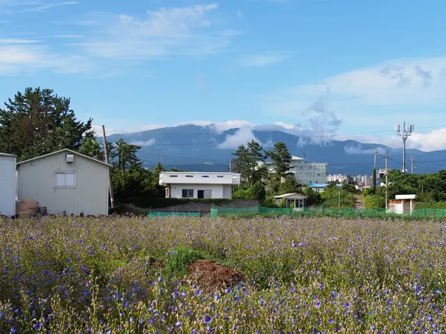
Tucked in the Colorado Rockies between Copper Mountain and Leadville, the Clinton Gulch Dam Reservoir trail offers a picturesque, easy hike that's an often-overlooked gem. Accessible right off Highway 91, this 2.4-mile loop trail presents stunning alpine vistas with limited effort, making it an ideal stop for road-trippers and casual hikers craving scenic mountain views without steep elevation gains.
Whether you visit during summer for wildflower spotting or in winter for snowshoeing, the Clinton Gulch Dam Reservoir hike is a year-round delight deserving a spot on your Colorado hiking itinerary.
Hiking Details
The Clinton Gulch Dam Reservoir hike entails a simple, self-guided loop around the lake. With a minimal 230-foot elevation gain spread over 2.4 miles, this trail boasts an easy difficulty level, especially compared to most mountain hikes. Keep in mind that the trail is relatively thin, necessitating single-file hiking.
Follow the trail along the lake's shore, experiencing the diverse landscapes as you traverse the loop. The northern side features open terrain and willow-filled brush, while the southern side offers forested areas, wildflowers, mushrooms, and mini steam pockets flowing into the lake. On the eastern end, you'll find a sprawling meadow and a manageable stream crossing, which showcases some of the trail's most stunning views.
Historical Background
Named after Clinton Peak, the nearby 13,864-foot summit that serves as the headwaters for Clinton Creek, the reservoir came into existence in 1977 when the Climax Molybdenum Company constructed the dam to aid mining operations. In 1992, the reservoir was sold to the Clinton Ditch & Reservoir Company, which includes several Summit County towns and ski resorts. A portion of the water is now used to create artificial snow on select ski slopes each winter.
Getting There
Found on the stunning Top of the Rockies Scenic Byway, a 115-mile driving route in central Colorado, the Clinton Gulch Dam Reservoir is conveniently accessible from two parking areas on either side of the dam. Park in either location, as the trail is a loop and begins and ends at the same point.
Fishing Opportunities
During the hike, we spotted multiple fishermen stationed along the lake's edge with fishing lines cast in the water. With a valid Colorado state fishing license (for those aged 16 and older), you can fish year-round for Cutthroat Trout, Rainbow Trout, and Brown Trout.
Worthy Recommendations
Although its simplicity may lead you to underestimate its charm, the Clinton Gulch Dam Reservoir trail boasts breathtaking views, a sparkling lake, and the opportunity to fish for various trout species. We highly recommend this hike for anyone seeking an easier adventure or for families. Due to the trail's elevation at approximately 11,000 feet, it also serves as a convenient option for those acclimating to the high altitude.
Nearby Hikes
Exploring the area further? Consider these nearby hikes:
- Mayflower Gulch
- Description: A historic ravine featuring mining remnants, breathtaking mountain panoramas, and flexible lengths, making it popular with history enthusiasts seeking adaptable adventures.
- Activities: Hiking, snowshoeing, cross-country skiing
- Lower Cataract Lake
- Description: An effortless 2.3-mile trail near Silverthorne, offering birdwatching, wildflower spotting, and scenic vistas.
- Activities: Hiking, birdwatching, photography
- Wheeler Lakes
- Description: A 6.6-mile round-trip hike outside Copper Mountain and Frisco, leading to two picture-perfect alpine lakes and an abundance of wildlife, including the elusive tiger salamander.
- Activities: Moderate hiking, wildlife viewing
Frequently Asked Questions
Where is Clinton Gulch Dam Reservoir?Located between Copper Mountain and Leadville along the Top of the Rockies Scenic Byway (State Highway 91), the reservoir is readily accessible from two parking areas on either side of the dam, surrounded by a 2.4-mile easy hiking trail.
What is the elevation of Clinton Gulch Dam Reservoir?The trail around the reservoir ranges in elevation from 11,076 to 11,161 feet. The reservoir itself sits at roughly 11,050 feet.
Can you fish at Clinton Gulch Dam Reservoir?Yes! With a valid Colorado state fishing license (for ages 16 and older), you can fish for Cutthroat Trout, Rainbow Trout, and Brown Trout in the reservoir year-round.
- The Clinton Gulch Dam Reservoir trail, an easy hike in the Colorado Rockies, not only offers scenic alpine vistas but also provides fishing opportunities for various trout species, making it a must-visit for outdoor enthusiasts seeking an appealing blend of hiking, wildlife viewing, and fishing.
- With a loop trail length of 2.4 miles, minimal elevation gain, and diverse landscapes including meadows, forests, and steam pockets, this trail is ideal for families, casual hikers, or those acclimating to high altitudes.
- If you enjoy exploring nearby hikes, consider Mayflower Gulch, Lower Cataract Lake, or Wheeler Lakes. Each trail presents unique experiences, ranging from history, cross-country skiing, wildlife viewing, to birdwatching and photographing stunning mountain panoramas.


